The funding application was approved! We now have a Mesolithic style hut on our campus and we documented the building process by videorecording it from three different perspectives, so that we now have interactional data for use in EMCA, linguistics, archaeology, architecture, sociology and museum studies. We encourage anyone from those or other fields to get in touch if you are interested in cooperation.
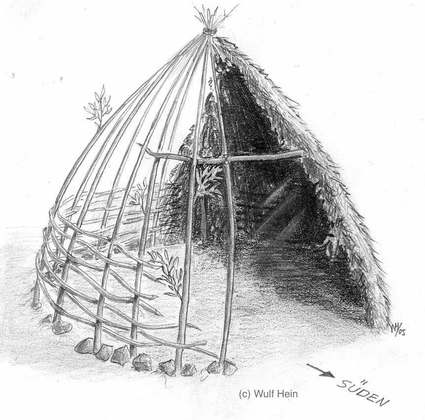
The hut was built by the legendary Wulf Hein and colleagues Cornelia Lauxmann and Ruth Hecker (http://arc-tech.de) with the help of volunteers and was modeled on a local find from Brandenburg. More on the theoretical background of the project can be found here.
The hut project is the start of a new Interaction Lab that is planned to comprise a number of different prehistoric structures to investigate various aspects of social interaction in heritage environments. Follow us on this blog and on Instagram (the.interaction.lab https://www.instagram.com/the.interaction.lab/) for updates.
Thanks go to the Spotlight program by PROFUND Innovation and to the Department of Philosophy and Humanities for their support. Read about the funding program and other fascinating projects here.
This is the type of hut we used as a model – the main materials are hazel and willow.
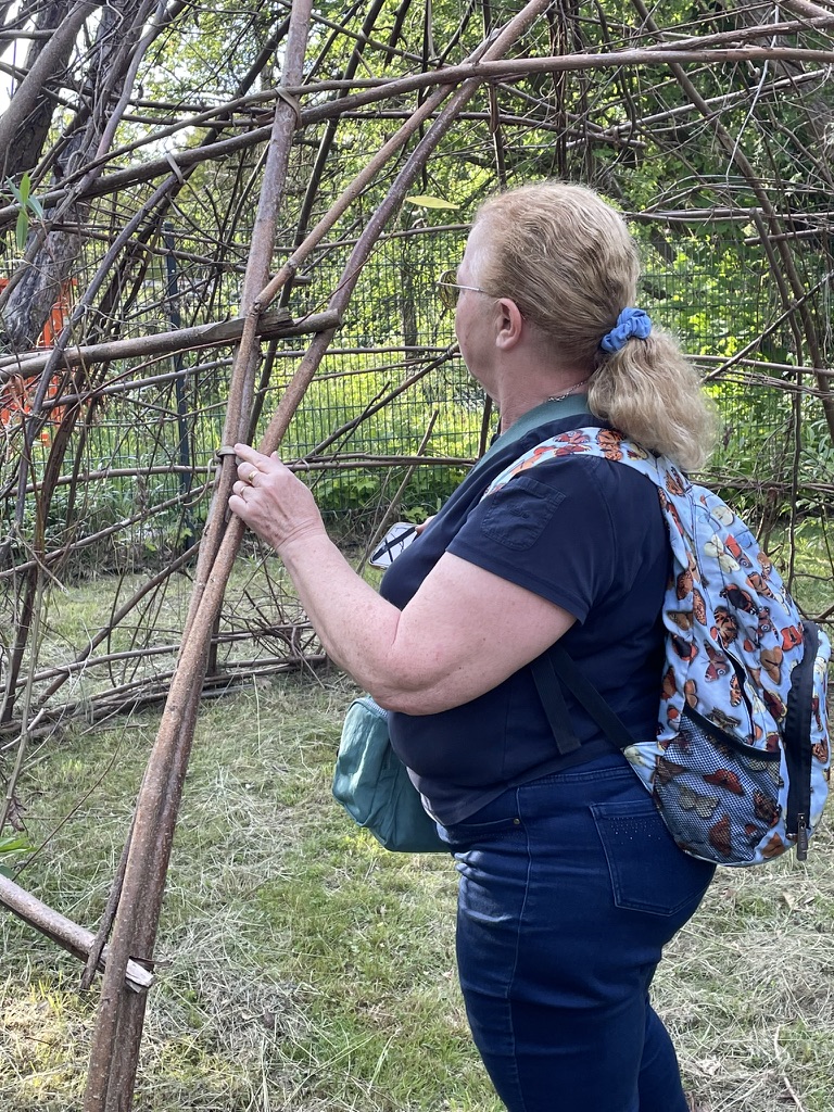
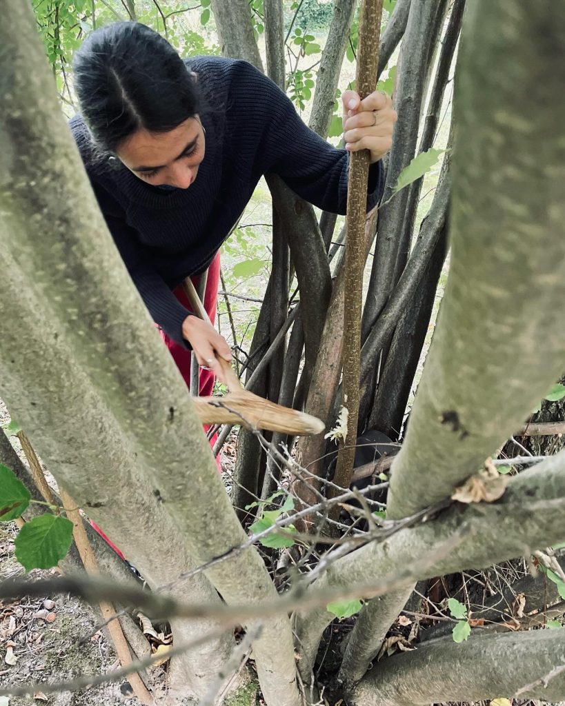
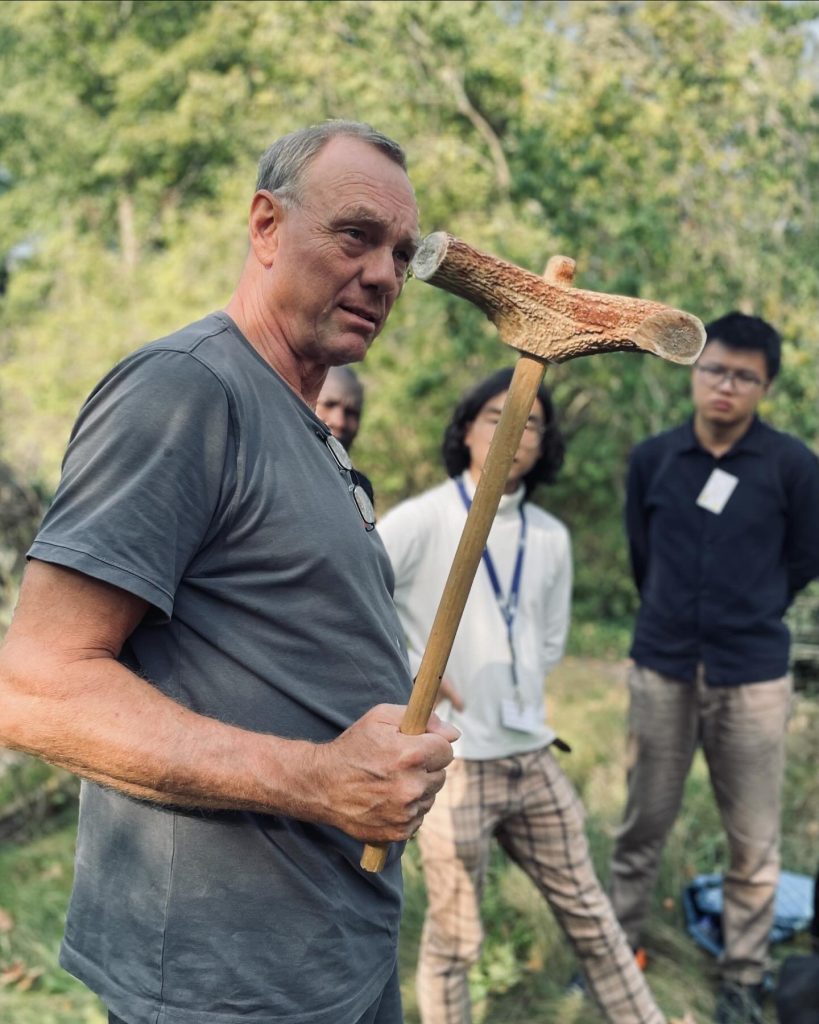
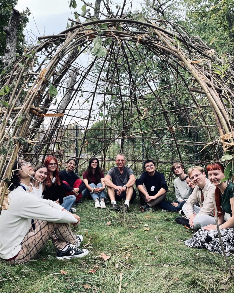
It’s been a while ago, but nevertheless it’s newsworthy: in September 2024, a group of students, joined by our expert in ancient technology Wulf Hein, took stock of the hut for a bit of refurbishing. It had faced the forces of time and weather for over a year and had started to deteriorate in accordance with the properties of the materials that we used in its construction, as testified by Prof. Linda Hurcombe, expert on material culture in prehistory.
Prof. Linda Hurcombe assesssing the state of the hut in May 2024
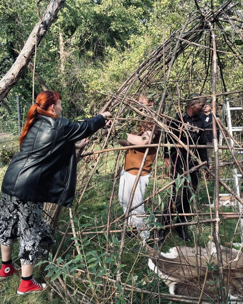
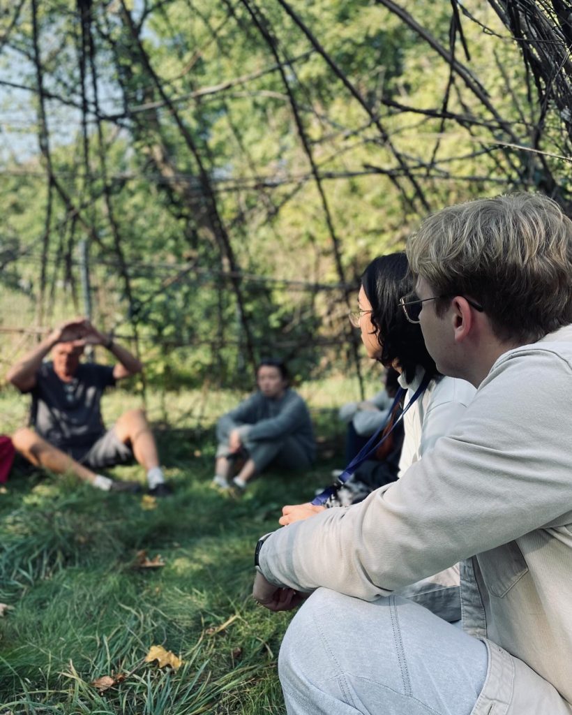
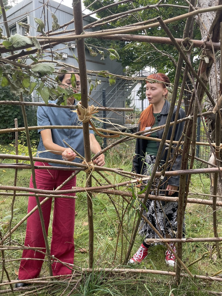
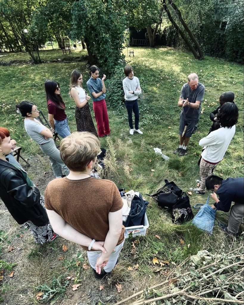
Getting the hut back into shape was organised as a so-called micro challenge – a two-hour workshop format with a hands-on component offered during the Una Europa Student Congress. The overarching theme of the congress was Dis-/Assemble: Reinventing the University, and out maintenance work fitted very well into the idea of re-assembling in a very literal sense.
The activity brought together a diverse and engaged group of students from various Una Europa partner universities, each with their different courses of study and the knowledge drawn from a variety of disciplines. While engaging in hands-on building activities, we discussed the relevance of architectural structures for human social interaction, for the development of coordination and the role of language in that essential human task.
After a few hours of work and exchange, we proudly presented the newly refurbished hut – a big thank you again to all participants and Wulf for his continued support of the project!
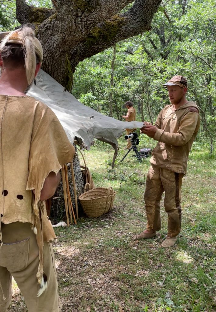
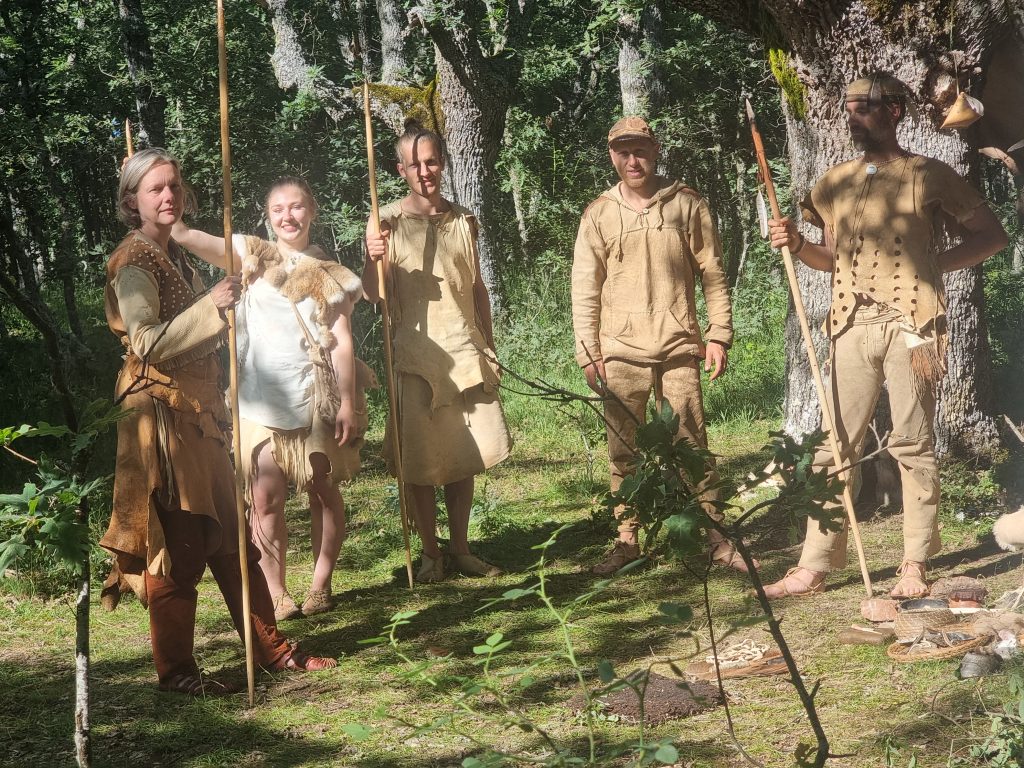
In June, I spent a week near Burgos in northeastern Spain as a participant and researcher of the ROOTS project, an initiative by Markus Klek from palaeotechnik.eu. The project invites people to share and explore the challenges of living in the past, in our case more specifically the western European Mesolithic/Neolithic transitional phase. The challenges affect all aspects of daily life, as food and cooking, clothing, the use of tools, craft activities, and the provision of shelter and warmth were dependent on the materials available at the time. This meant that neither metal or plastic was allowed, and that modern intrusions in the form of medical and other aids such as glasses were kept to a minimum (read more about the ROOTS project here).
This setting allowed for the collection of interactional data that showed how
participants adapt to unconventional and unfamiliar environmental, material and spatial affordances and
pastness, i.e. a relationship to and understanding of the past was enacted.
Particularly interesting interactions included the following settings and activities:
Creating and modifying space: Upon arriving in the area, a densely wooded landscape with oak trees, participants selected a suitable spot in the area to set up camp. To provide against the rather unreliable weather, the camp had to undergo several modifications to install more sheltered areas and to protect the hearth with the fire.
The planning and execution of such shelters required discussions and joint cooperative actions in the spatial environment of the camp, using material resources such as flint blades, plant-based string material and animal skins. Participants relied on their own experiential knowledge while at the same time (re)discovering knowledge and solutions that could plausibly be attributed to predecessors (for interaction with predecessors see e.g. Goodwin 2018). (Image credit: Antje Wilton)
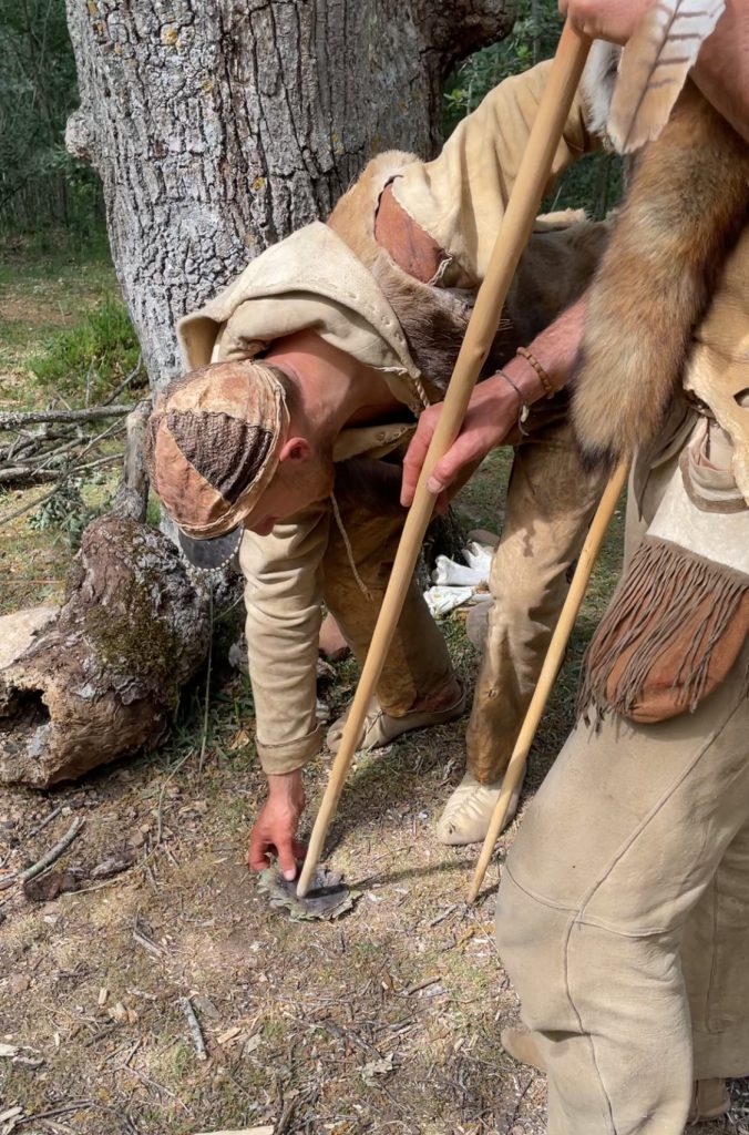
Exploring space: The group took frequent walks in the wider area, a paleolithic park which was populated by animals such as aurochs, bison and horse.
They also revisited previous camps, exploring and evaluating how the site had changed during their absence – in particular, how the passing of time had altered the appearance of objects that had been left behind. Such interactions provided insights into how the group moved within the area, how they reflected on previous uses of the space and how they interpreted traces of previous occupation with respect to social activities. (Image credit: Antje Wilton)
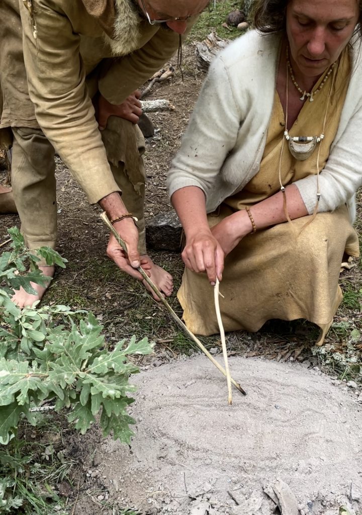
Conceptualizing space: As the group became more familiar with the area, their mental representations of the layout converged into common knowledge about where certain places are in relation to other places, and how they should be (or became) named.
This shared knowledge manifested itself in the creation of temporal maps, which participants drew into the ash and discussed together. Interestingly, the map not only emerged visually in space, but also temporally, as participants redrew the map several times with an increasingly narrow focus on the location of the camp. Additionally, the heap of ash allowed a vertical extension of the map into a 3D-model of the landscape. (Image credit: Antje Wilton)
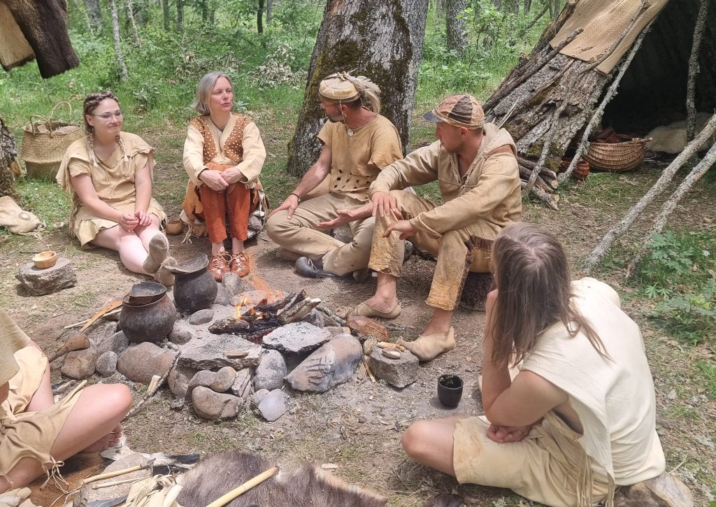
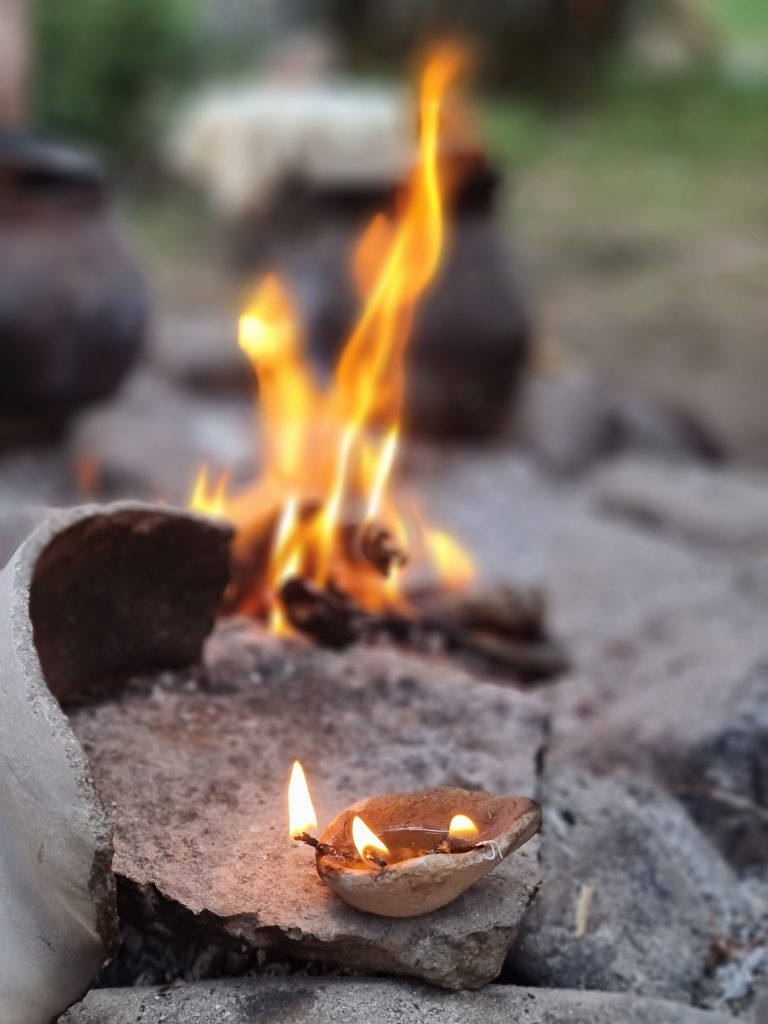
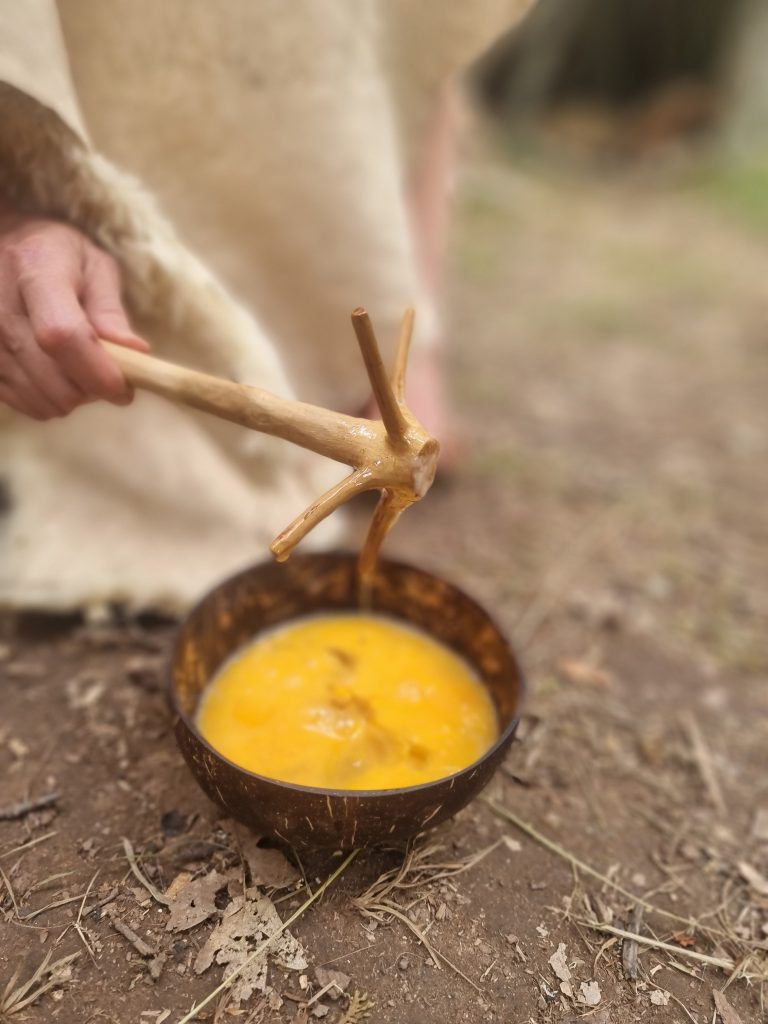
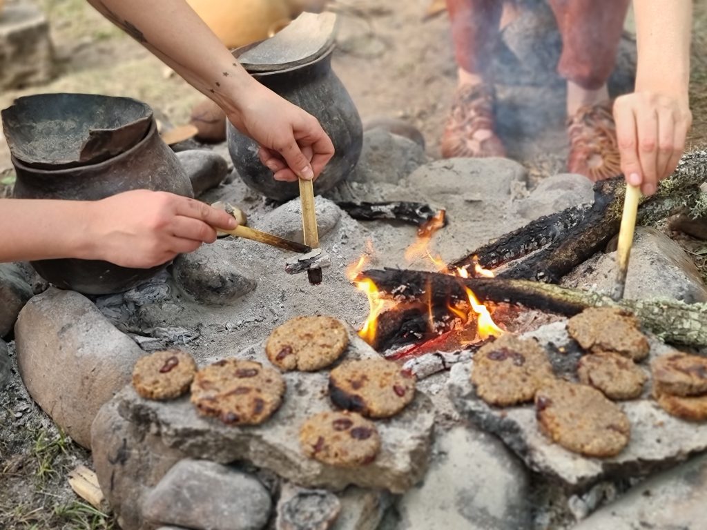
Using space: A central task of the group was to keep the fire in the hearth going during the day. The fire provided the main focal point of the camp, and participants gathered around the hearth to engage in various types of activities, such as cooking and crafts as well as discussions and storytelling. Through the activities, the hearth itself became structured into different zones, where heat regulation and vigilance were adapted to the task at hand, i.e. the cooking and heating of meals in a ceramic pot, the careful drying of freshly made pottery, the smoking of meat, baking on heated stones, roasting of hazelnuts in the hot ash, frying fresh fish etc.
This required constant coordination and joint action among participants sitting in different positions around the central hearth, continuously shaping and reshaping the interactional space (more on the concept of interactional space in Mondada 2014). (Image credit: Markus Klek)
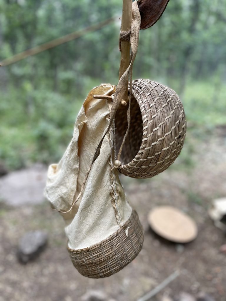
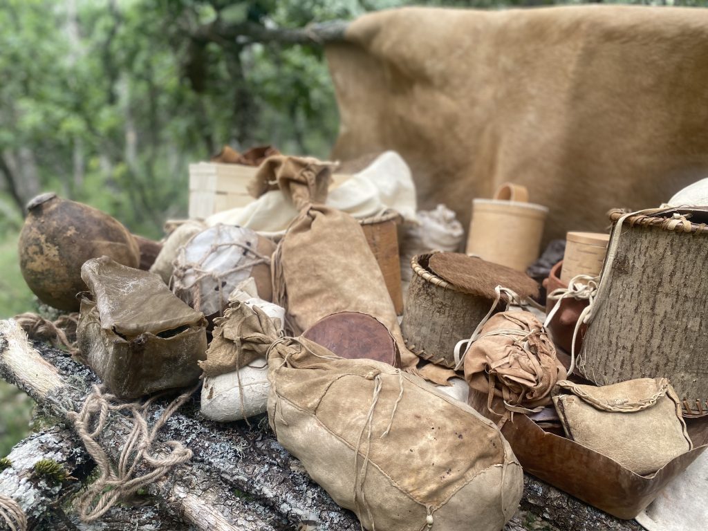
Baskets drying above the fire (image: Antje Wilton)Human-animal interaction (image: Antje Wilton)Food rack (image: Markus Klek)Testing different types of wick (image: Markus Klek)The neolithic whisk in action (image: Markus Klek)(image: Markus Klek)Using the hearth simultaneously for different activities (image: Markus Klek)
The insights we hope to gain with this new set of data are expected to shed more light on how pastness is enacted and achieved in interaction, how adaptation to environmental, material and spatial affordances manifests itself in interaction and how such behaviours inform us about basic human interactional processes in spaces where modern architectural infrastructure is minimal or absent.
Apart from being a rich source of interactional data, the week in the woods near Burgos was also great fun – thanks to a lovely bunch of people including Markus, Tine, Mike, Marian and Olga, and Eduardo and Estefania from Paleolitico Vivo!
The “clan” (image credit: Markus Klek)
To experience the area that has been home to humans for more than 850.000 years (and likely even much earlier), as evidenced by the world famous UNESCO World Heritage site of Atapuerca nearby, in such an immediate and immersive setting was truly inspiring and instructive.
In this guest post, Bjarne Kortmann, archaeology student at the Freie Universität Berlin and interested in 3D visualisation tools, shares his work on our hut and its implication for interaction studies with us.
More than half a year has passed since we built our Mesolithic hut, during which I assisted after responding to a call for volunteers that was passed around at my institute of archaeology of the ancient near east, located very near to the site where the hut now stands. During my studies, I had participated in projects of experimental archaeology whenever possible, and I imagined this project to be somewhat similar, at least from an assisting participant’s point of view. Over the last 2 years, I specialized in what is often called digital archaeology, particularly in anything related to 3D graphics. Due to this, I inquired if something in that direction may be of interest to the Interaction Lab. Luckily for me, the answer was yes. This is how I came to create different digital models and animations for the project in the weeks following the experiment, in order to explore the use of 3D graphics in interaction studies.
Among these, an animation of the construction process was created using the free and open source software Blender. This is a 3D computer graphics software whose comprehensive range of tools allows for the realization of virtually any desired visualization. Although most visualizations in archaeology consist of static models of hypothetical reconstructions of architecture, some projects also commission more laborious animations of construction processes, to showcase the building elements and their arrangement. In archaeology such visualizations are typically employed for the purpose of science communication to both the academic community and to the public. As common in archaeological reconstructions, the animation here does not cover the collection and preparation of the building materials, but the steps of assembling the building elements to form the hut. More time would have allowed for a more realistic visual style, but even highly simplified visualizations can transmit a vast amount of information.
The hut: steps of the building process (c) The Interaction Lab // Bjarne Kortmann
Simplified, stylized animations like these provide an overview of the process in which interactions took place, useful for those who were not part of the process and are – understandably – unfamiliar with the steps of building a Mesolithic hut. In this way, stylized animations of the abstracted physical process could aid in the contextualization of interactions. Emptied of the interactions that took place between participants and their environment, such a reduced visualization can perhaps also serve as a neutral starting point from which to investigate the interactions that did take place. After all, the absence of interaction helps to make apparent the plethora of possible interactions that could have occurred.
As an archaeologist, I am entirely unfamiliar with documenting actual interactions. We may reflect on our ways of interpreting finds and contexts or our methods of excavation and documentation, thus in a way interrogating our own interactions with our environment. Yet what we find and analyze in our daily work are not interactions, but the products of interactions. More precisely, the products of interactions after they have been altered by what we call taphonomic processes, meaning all that has happened to something after the interactions with humans stopped, such as decay, erosion, etc.
What archaeologists try to do, is to reconstruct interactions from this mixture. In short, it could be said that interactions are not our data, but inversely to this project, interactions are our results.
Take for example the concept of a chaîne opératoire, the sequence of steps in an artifact’s life. If we find a flint tool, we know that first, the raw material for it must have been acquired, then it must have been shaped, before it was likely used and then lost or discarded. This process can contain additional steps in it and even loops. Each step is an interaction of a person or a group with its environment, and the nature and sequence of these human-environment interactions may then inform our understanding of those involved.
Therefore, archaeology has adopted many technologies and methods to record objects and spaces in great detail, so that traces of these interactions are not lost. Traditionally restricted to two-dimensional representations, these records have begun to include three-dimensional representations. The perhaps most common method of creating 3D models in archaeology is photogrammetry. This method uses overlapping photographs to calculate the shape and size of an object. Provided that each image in a series of images is ca. 75% overlapping with the next image, different software can reliably calculate a 3D model from these images. Staying with the example of the lithic tool, a photogrammetric model of such an artifact would allow visual reinspection beyond the static confines of photography. Features shaped by tools or marks from the object’s use can be looked at dynamically from any angle. A 3D model likewise allows researchers to conduct measurements on the object, without having the object in hand. Whether in international cooperation or for the reusability and reproducibility of data and reconsideration of interpretations, these are important abilities. Digital tools such as looking at a section of the object’s model at any point or calculating its volume additionally expand the ways in which an object can be investigated. As photogrammetry is in principle agnostic of scale, the same is possible with much larger contexts, such as entire buildings or even landscapes. As excavation always means destruction of the excavated layers and the context of finds can never be reconstructed in the real world, digital 3D models of excavations offer much-needed versatility to excavation documentation, much beyond what individual photos or drawings could offer. Larger photogrammetric models of landscapes, the photos for which are typically captured with drones, allow for the contextualization of archaeological sites and investigations into meaning and use of landscapes.
But how could photogrammetric models benefit interaction studies? As for each model, dozens, if not hundreds of pictures are needed, interactions themselves cannot be captured through photogrammetry. As an outsider to the realm of interaction studies, I could imagine photogrammetric models of the spaces in which interactions took place to be of use, for the above-mentioned purpose of interaction contextualization. Perhaps, it would also be beneficial to be able to revisit the physical products of interactions, and inspect them more freely than would be possible through photographs or videos. To explore these possibilities, a 3D model of the hut we built was created. Photogrammetry algorithms struggle with objects that have holes or thin appendices and with reflective objects. This means that our hut was quite the challenge, being full of small gaps between the leaves, with individual branches sticking out in many places, and each leaf being wet, reflecting sunlight after a rainy day. But after trying out different sets of images, different software, different calculation processes and different settings, a serviceable model was created using a specific method (calculating a model from depth maps) available in Agisoft Metashape, which offers educational licenses for students and staff of educational institutions. Anyone interested in the technical details is welcome to contact me.
The hut: photogrammetry model (c) The Interaction Lab // Bjarne Kortmann
This model was generated with what is referred to as videogrammetry, which means that instead of photos, a video was used as input for the software, which then extracted the necessary frames to generate the model. In this particular visualization, some artificial additions were made to the model after importing it into Blender, giving it the appearance to sit on a slice of the ground. The depth of this podium of earth was chosen to represent the approximate depth of the vertical posts that give the hut its shape, the insertion of which can be seen in the animation of the building process.
Beyond the potential use cases mentioned above, photogrammetric models and manually modeled scenes, similar to the construction animation, could also be used in further visualizations and be used in conjunction with each other, as in the scene below, again created with Blender. Virtual characters could be posed and even animated to reenact interactions that may not have been captured from the desired angle during the experiment. Visualization of hypothetical or alternative interactions would likewise be feasible. Though perhaps not of direct use for research, 3D graphics can also be used for digital storytelling, helping among other things to present the context of a project or an experiment and aid in effective science communication, as increasingly recognized in archaeology.
The hut: hypothetical landscape setting (c) The Interaction Lab // Bjarne Kortmann
A glimpse into the Brandenburg State Museum of Archaeology
In this guest post, Fatima Wollgast and Sandra Lehninger take us to the Brandenburg State Museum of Archaeology, where some of the most important finds from Mesolithic sites in the area are on display.
In the permanent exhibition of the Brandenburg State Museum of Archaeology a separate room is dedicated to the Mesolithic. For our region, this period is dated to around 9500 to 5500 BC. Its end is marked by a long transitional phase towards the Neolithic. Late Mesolithic groups are still recorded for the 5th millennium BC. They were neighbours of established farming cultures.
The virtual tour of the permanent exhibition includes the Mesolithic as well. The state of Brandenburg has Mesolithic sites of international importance. Accordingly, a large part of the exhibition material comes from the sites of Friesack, which have been visited repeatedly by Mesolithic groups over centuries. The well-preserved organic material provides insights into the living environment of those people: A fishing net made of willow bast – one of the oldest nets in the world – , net sinkers and floats, fishing hooks, harpoons, a probable paddle fragment, a decorated turtle shell, a birch bark vessel, fruit and plant remains or an elaborately decorated hole stick – all from Friesack – are on display in the exhibition.
The burial sites of Criewen and Groß Fredenwalde are also featured. The latter has made headlines in recent years. Thanks to new excavations, Groß Fredenwalde is now considered one of the largest Mesolithic burial sites in north-central Europe with 12 buried individuals – and the research goes on.
Exhibits from other sites give visitors a further impression of Mesolithic living conditions: The skeleton of an aurochs, typical microliths and early axe forms are among them. For those who want to learn more about this period, a media station offers information on climate, flora and fauna. Film sequences show the use of prehistoric hunting weapons.
Considering the museum’s educational programme, the Stone Age in general is of great interest. In active guided tours children and teachers, supported by the museum educator, can learn more about the special features of each Stone Age period. The tour is illustrated with material to touch, wear and try out, as well as with numerous illustrations. Further, simple questionnaires that encourage the exploration of the Stone Age rooms of the exhibition are part of the programme.
Unfortunately, the Mesolithic itself is less well known than other parts of the Stone Age as it is hardly thematised in school or in the media. Therefore replicas and objects made of natural materials as well as bark, dried fruits, berries and mushrooms are used in the guided tour for kids. The aim is to teach the children about the natural resources that were available to Mesolithic people. On request kids can also try their hand at making red natural dye, as it is known from graves of this period. In a time when environmental protection, healthy nutrition and natural resources are central topics, dealing with the Mesolithic has great potential. Which child (and which adult) can imagine that people once lived in and with nature? That all their needs were met from their immediate environment? Or that birch juice is tasty, water lily roots are edible and fibers can be made from nettles?
For older students, a more complex worksheet on the topic of “humans and environment” can be used. It provides information on the topic of climate, environment and survival strategies of people. These questionnaires are already available for the Palaeolithic and Mesolithic periods. For other time periods, they are currently in progress.
Finally, the Mesolithic is, of course, repeatedly addressed in various events and lectures. For example, the reconstruction of Mesolithic food plays a role at this year’s ARCHÄOTECHNICA, a two-day event on Nutrition through the Millennia. A lecture planned for November 2023 on the current research results at the well-known Mesolithic cemetery of Groß Fredenwalde as well as a smaller specialist conference on Mesolithic in 2024 will also deal with this period from a Brandenburg perspective.
Fatima Wollgast M.A. Sandra Lehninger M.A. Brandenburg State Authorities for Heritage Management and State Museum of Archaeology
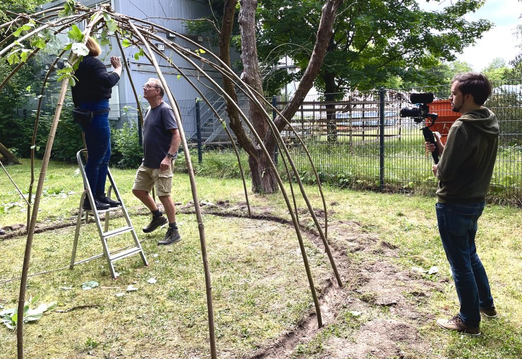
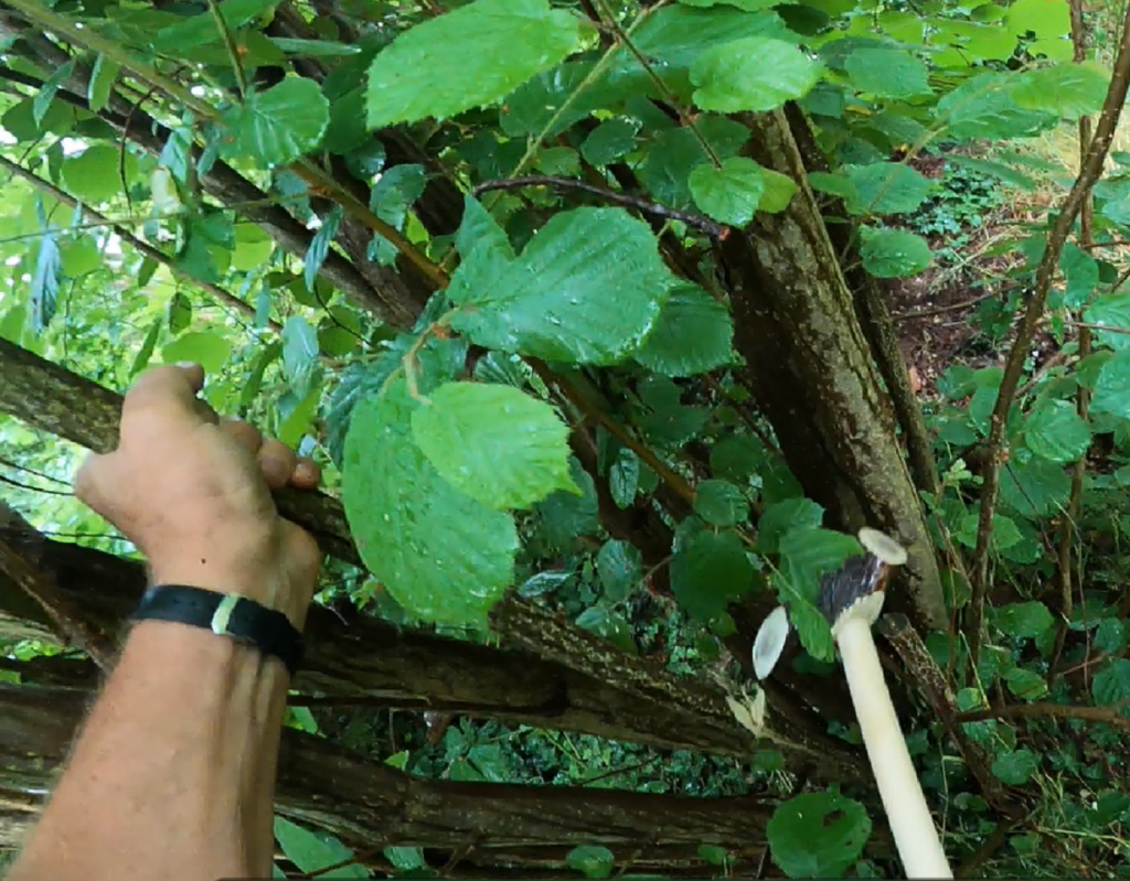
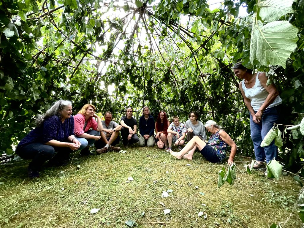
Our hut building weekend was a great success – we now have a robust domed structure made of hazel and tied with leather and rawhide strips. We have also started to cover the structure with hazel branches and living willow to provide some shade, and some sense of “inside” and “outside”. Experts, students and volunteers worked together for three days to collect materials from a nearby grove, lay out the dimensions and position of the hut and turning the structure of long and sturdy hazel branches into a domed round building. Replica of Mesolithic tools such as antler axes and flint blades were used for procuring and preparing the branches and leather and rawhide strips. During the Long Night of Sciences (Lange Nacht der Wissenschaften) on June 17, 2023, visitors were able to participate in the hut building by helping to integrate hazel branches into the structure. Additionally, they were given the opportunity to explore materials like birch bark (provided by Sagaan) for making containers and to try roasting hazelnuts in hot sand – this worked very well!
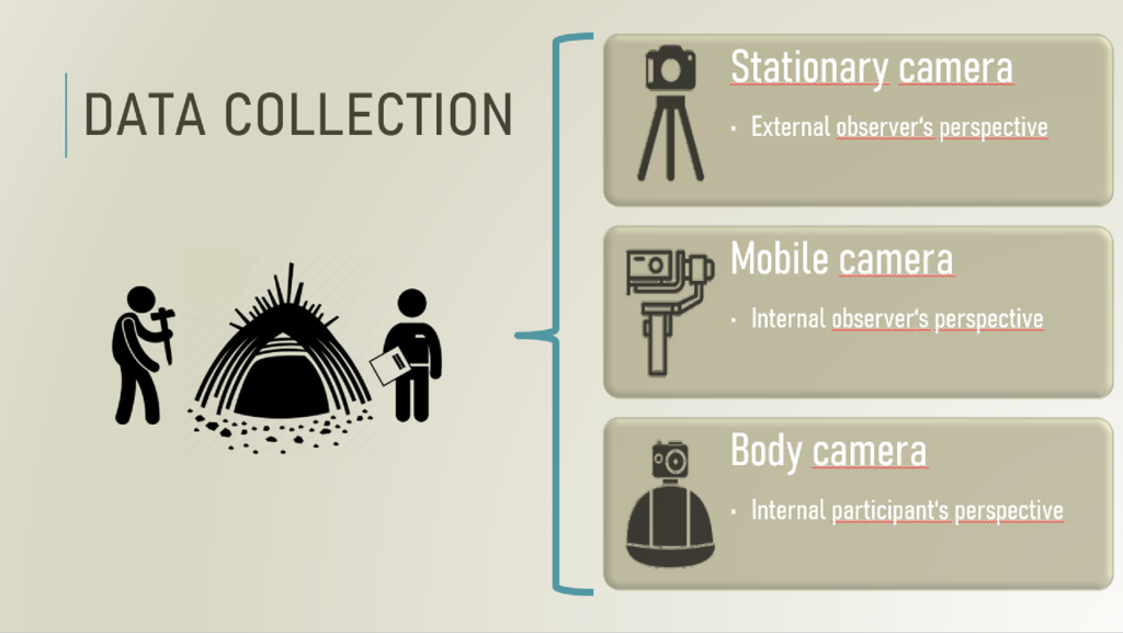
During those three days, we filmed many of these activities with the consent of participants and got very promising interactional data. We used three types of cameras to documents three different perspectives: a static camera to provide an external observer’s view, a mobile camera to provide an internal observer’s view, and bodycams to provide internal participants’ views.
(c) Antje Wilton // All icons from www.thenounproject.de
What next? We plan to make the hut more durable – and potentially habitable – by applying a suitable cover. We are looking forward to cooperate with the Institute for Prehistoric Archaeology and our new colleague Prof. Dr. Henny Piezonka at the FU Berlin on all things Mesolithic, and in particular to discuss possible materials and techniques for covering the structure that we can assume were used in the Mesolithic on the North German Plain. If we can get the materials required, we will send out a call again for anyone interested in participating in the next building phase – hopefully sometime in the autumn, so stay tuned if you are interested!
Furthermore, work on the data has already begun. Together with our colleague Kenan Hochuli from the University of Zürich we currently work on our presentation for session #202 of the upcoming EAA conference in Belfast – the session brings together contributions on the social aspects of building in pre- and protohistoric times. We hope to be able to stimulate the discussion and get some valuable feedback on the relevance of interactional research for the investigation of past architectural spaces!
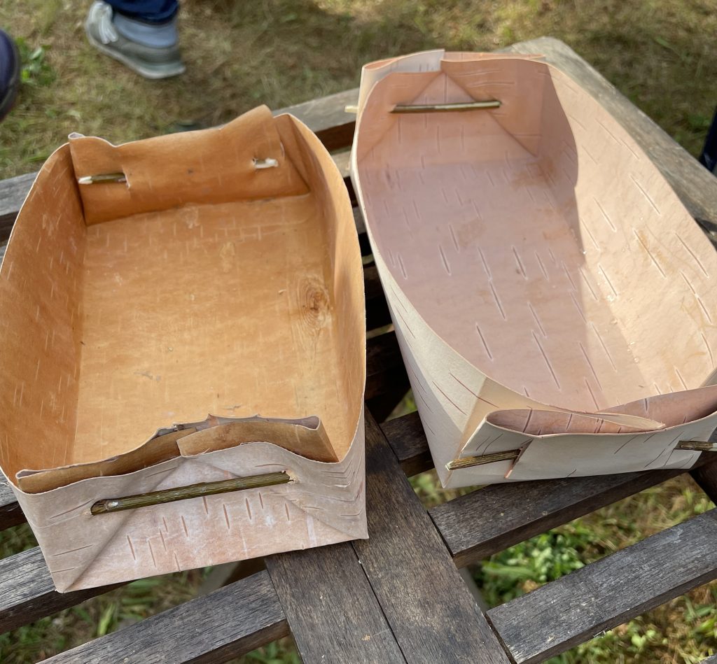
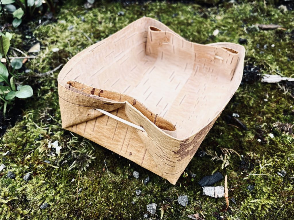
One of the craft activities we will offer during the construction of our Mesolithic hut is making a simple container from birch bark. Bark was a common material in the Mesolithic – in fact, throughout the stone age and beyond, as it is extremely versatile. In the archaeological record, we find mats and containers of different shapes and sizes preserved primarily in waterlogged ground, where the absence of oxygen helped to preserve otherwise degradable objects. Birch bark was also necessary for the production of birch tar, a sticky substance used like glue, for instance to attach projectiles to shafts for making arrows or spears.
Our container is modeled on a find from Friesack (Brandenburg), an important Mesolithic site on the North Geman Plain. At Friesack, an extraordinary number of finds made of organic materials such as wood, bark and bast were preserved (Gramsch 2000). Detailed information on the site can be found in the publications by Bernhard Gramsch, one of which introduces the birch bark container we are interested in for our project. The following discussion is based on that publication (Gramsch 1993).
One of the features discovered at the site was a former waterhole, the remains of which were indicated by soil marks. At the bottom of the pit, archaeologists found an almost complete container made from birch bark – radiocarbon dated to about 8950+/-100 BP (OxA-600), (see figure 1).
The container was perfect in the way it was made: a piece of birch bark, measuring about 32×18 cm, was seamlessly folded to make the container watertight, a method well documented since the Mesolithic until the present day (Piezonka 2023). The container was deformed by the pressure of the accumulated soil in the waterhole, but its original dimensions were given as 16x6cm. The height cannot be determined exactly because of damage to the container’s rim, but is thought to be about 6cm. The production process can be reconstructed as follows: the shorter sides were folded over by about 2cm. The shorter sides were folded upwards first, then the longer sides, which created diagonal folds in the corners. Those were folded across the shorter sides and then pierced with two holes. Presumably, either wooden sticks or possibly some sort of string were then threaded through the holes to secure the folds. However, they do not survive in the archaeological record. Figure 2 shows a model illustrating the technique.
Figure 2: Model illustrating the birch bark container folding technique. Source: (c) Antje Wilton.
We do not know for sure what the container was used for – its position at the bottom of the waterhole makes it very likely that it was used to collect water from the hole and got lost or was thrown away after use, or maybe that it was deposited there intentionally for a symbolic purpose. Either way, such easily made containers must have been widely used in many different contexts – we will explore both the making as well as possible applications together with our visitors!
References:
Gramsch, Bernhard (1993): Ein mesolithischer Birkenrindenbehälter von Friesack. Veröffentlichungen des Brandenburgischen Museums für Ur- und Frühgeschichte 27, 7-15.
Gramsch, Bernhard (2000): Friesack: Letzte Jäger und Sammler in Brandenburg. Jahrbuch des Römisch-Germanischen Zentralmuseums Mainz 47, 51-96.
Piezonka, Henny (2023): A view from the northern forests: Container technology of boreal hunter-gatherers. In: Nieuwenhuyse, Olivier P.; Bernbeck, Reinhard & Berghuijs, Koen (eds.): Containers of Change. Ancient container technologies from Eastern to Western Asia. Leiden: Sidestone Press, 155-176.