QGIS is a open-source geographic information system (GIS) for viewing, manipulating, and gathering spatial data and is licensed under the GNU General Public License. Essential features of the application are the broad support of common vector data and raster data, e.g., shapefiles and GeoTIFFs. There is an integration of sophisticated digitizing tools for creating vector data, as well as tools for a easy creation of cartographic maps, which you can use in publications and final papers.
The layout and appearance of QGIS is highly modifiable. The panels in our virtual machine are arranged as follows:
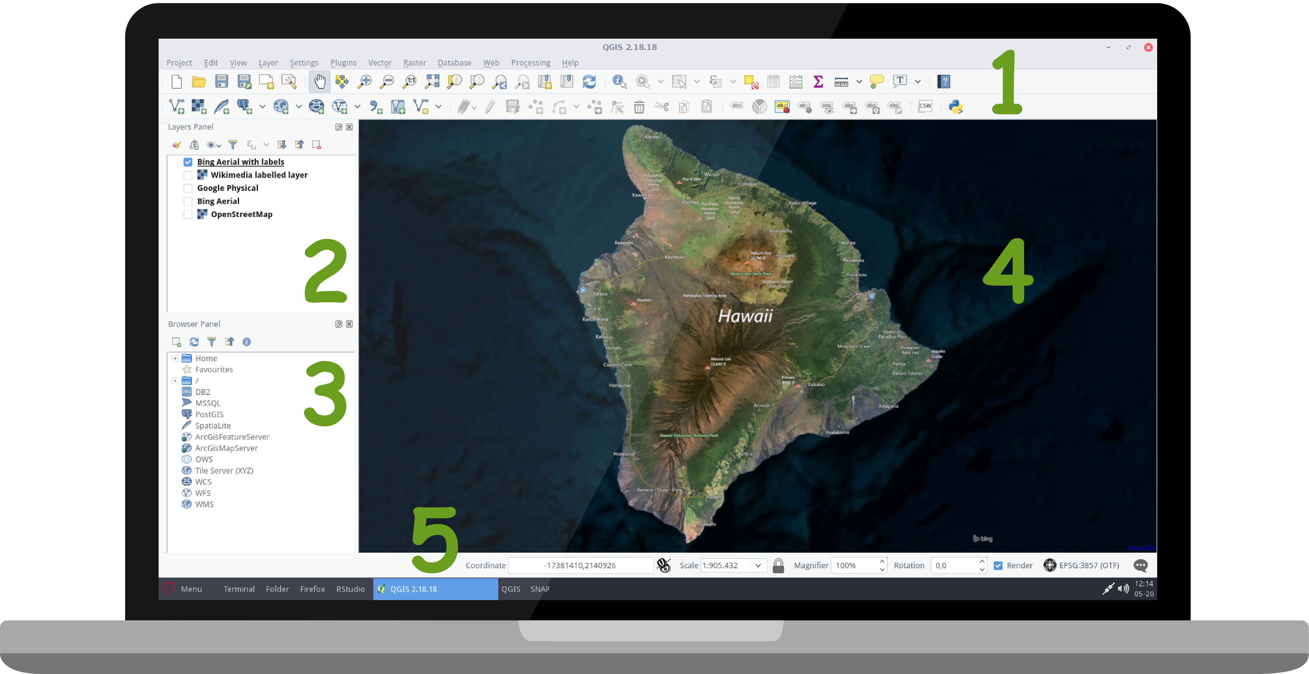
- 1 Main Menu and Toolbars: various toolbars available, e.g., project toolbar for QGIS project management, map navigation toolbar, attributes toolbar for feature selection and identification, layer management toolbar for adding new layers, and many more. Right click in the toolbar area in order to select/ deselect the individual toolbars and panels
- 2 Layers Panel: shows all data layers in your current QGIS session. The data layers listed at the top are those that are visible in the data view on top. Rearange the order by left-clicking one layer and then dragging and dropping it to the desired location. You can hide individual layers by removing the checkmark next to it
- 3 Browser Panel: lets you navigate in your filesystem and manage geodata. You can have access to common vector files, databases and WMS/WFS connections
- 4 Map View: visualize all your vector and raster data loaded into your current session (layers panel)
- 5 Status Bar: get all the information about the coordinates of where the mouse pointer is pointing, the scale, magnifier, rotation and the current coordinate system of your QGIS session
So why do we use QGIS over other geographic information systems? At first it does not cost a penny and supports all types of operating systems. This is why the community is big and there are lots of help and tutorials available online, e.g., the official User Manual or internet forums, such as Stack Exchange. Furthermore it is actively developed by the QGIS Development Team and volunteer developers who regularly release updates and bug fixes.
We will mainly use QGIS in this online course to prepare classification maps accordingly in sections Visualization and Visualize in QGIS.